
Search Map
Various Types of Maps of Provinces, Districts & Municipalities
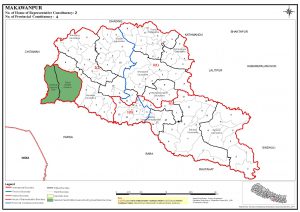
Makwanpur District had 2 Federal Constituencies and 4 Provincial Constituencies with total registered voters - 420,477 in 2017 Election. Makwanpur had total population 227,759 as per 2011 Census. (Source: Nepal Election Commission)
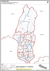
Mahottari District had 4 Federal Constituencies and 8 Provincial Constituencies with total registered voters - 627,580 in 2017 Election. Mahottari had total population 308,404 as per 2011 Census. (Source: Nepal Election Commission)
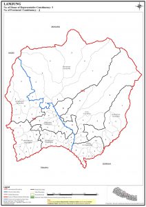
Lamjung District had 1 Federal Constituencies and 2 Provincial Constituencies with total registered voters - 167,724 in 2017 Election. Lamjung had total population 105,992 as per 2011 Census. (Source: Nepal Election Commission)
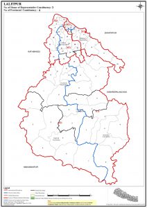
Lalitpur District had 3 Federal Constituencies and 6 Provincial Constituencies with total registered voters - 468,132 in 2017 Election. Lalitpur had total population 213,073 as per 2011 Census. (Source: Nepal Election Commission)
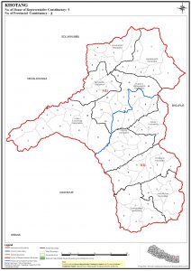
Khotang District had 1 Federal Constituencies and 2 Provincial Constituencies with total registered voters - 206,312 in 2017 Election. Khotang had total population 115,644 as per 2011 Census. (Source: Nepal Election Commission)
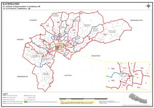
Kathmandu District had 10 Federal Constituencies and 20 Provincial Constituencies with total registered voters - 1,744,240 in 2017 Election. Kathmandu had total population 559,400 as per 2011 Census. (Source: Nepal Election Commission)
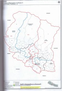
Kaski District had 3 Federal Constituencies and 6 Provincial Constituencies with total registered voters - 492,098 in 2017 Election. Kaski had total population 224,811 as per 2011 Census. (Source: Nepal Election Commission)
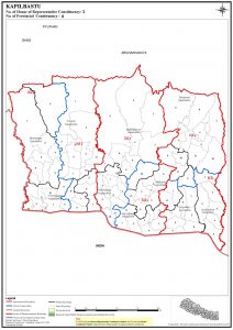
Kapilvastu District had 3 Federal Constituencies and 6 Provincial Constituencies with total registered voters - 571,936 in 2017 Election. Kapilvastu had total population 286,548 as per 2011 Census. (Source: Nepal Election Commission)
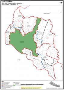
Kanchanpur District had 3 Federal Constituencies and 6 Provincial Constituencies with total registered voters - 451,248 in 2017 Election. Kanchanpur had total population 235,735 as per 2011 Census. (Source: Nepal Election Commission)
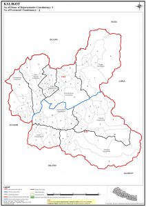
Kalikot District had 1 Federal Constituencies and 2 Provincial Constituencies with total registered voters - 136,948 in 2017 Election. Kalikot had total population 61,028 as per 2011 Census. (Source: Nepal Election Commission)
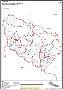
Kailali District had 5 Federal Constituencies and 10 Provincial Constituencies with total registered voters - 775,709 in 2017 Election. Kailali had total population 403,280 as per 2011 Census. (Source: Nepal Election Commission)
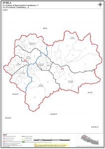
Jumla District had 1 Federal Constituencies and 2 Provincial Constituencies with total registered voters - 108,921 in 2017 Election. Jumla had total population 54,677 as per 2011 Census. (Source: Nepal Election Commission)